Why Paper Maps Are Still Useful - Jim Thorpe Trail Map

Paper maps aren’t dead! I strongly believe that there is a case to be made for paper maps to be used in addition to moden technology like smart phones and GPS. I created this video to show a general overview of the Jim Thorpe Trail Map and how it can be used to supplement your navigation toys like watches, phones, and GPS.

In this video I do the following:

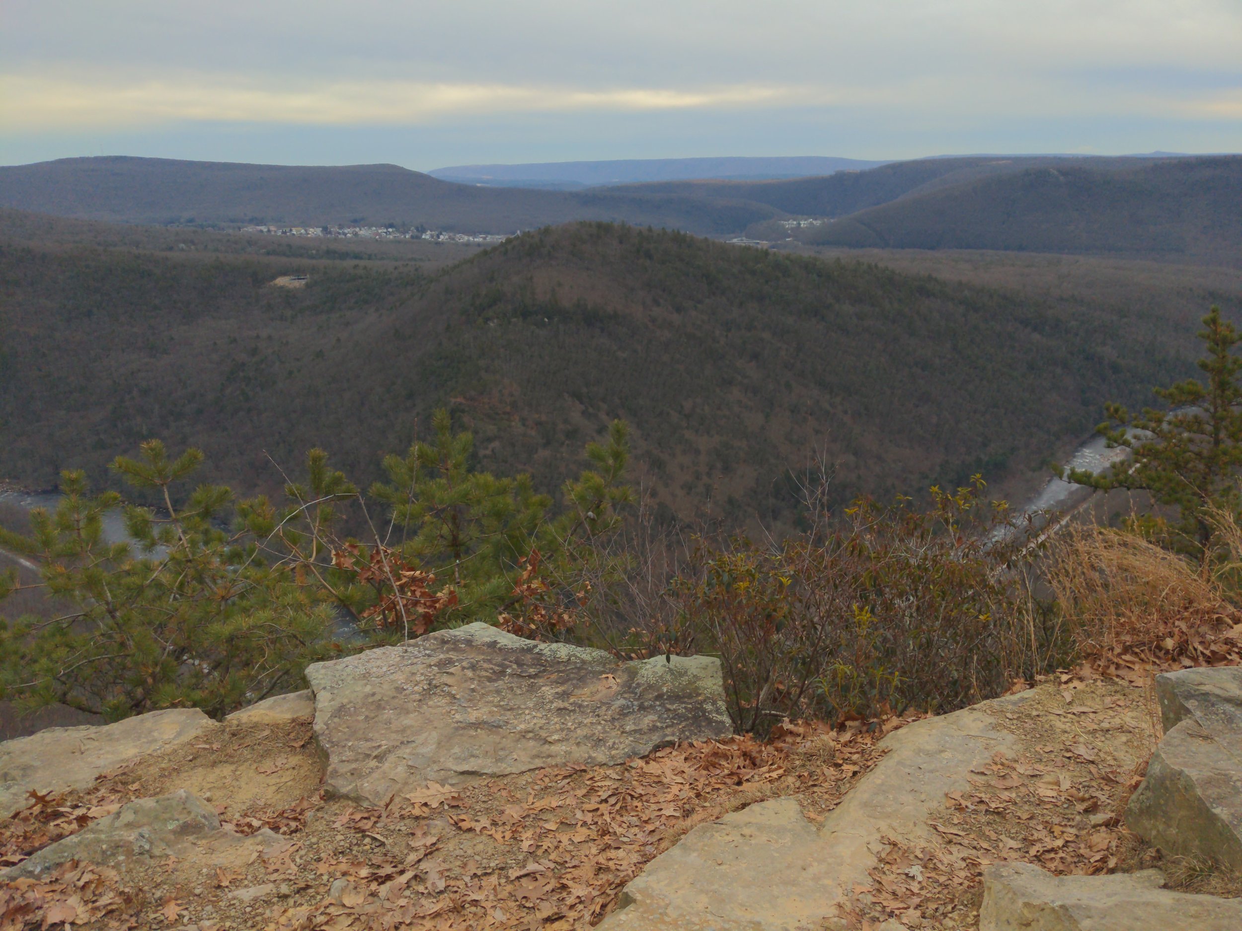
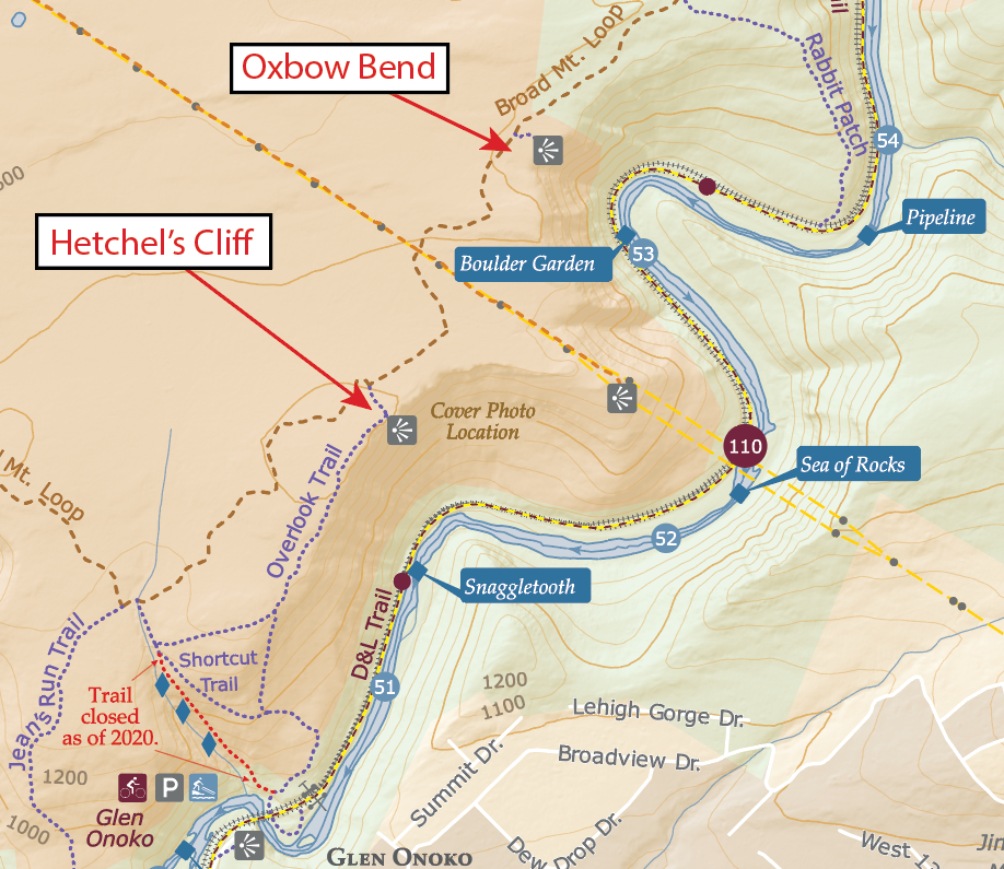
  1. Present the Jim Thorpe trail map and its general location and features

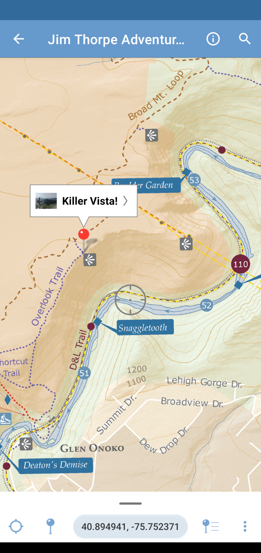
  2. Find where I am on the paper map using a mobile-friendly webmap accessed by a QR code

  3. Demonstrate how avenza maps can be used on a mobile device if we need to navigate in areas without cell reception

  4. Explain how to plan a route using the paper map, then access a GPX route of that plan

  5. Upload the GPX route to a GPS enabled smart watch (Suunto)

  6. Get out there and explore after!

Glen Onoko Falls Trail - What can you still do with the trail closed?

In 2020 the picturesque waterfall trail in Jim Thorpe, Pennsylvania was closed. This came as very sad news to many people who have enjoyed the trail for decades. Too many dangerous and sometimes fatal incidents occurred on the rocky and steep hike. Despite the waterfall trail being closed, there are several other beautiful trails and vistas in the vicinity that are worth visiting. This blog post is about those locations.

One of the lower falls at Glen Onoko

There are still LOTS of beautiful vistas and trails that are open and accessible! Two of my favorites are Hetchel’s Cliff and Oxbow Bend. You can access both of these without violating the trail closure.

Oxbow Bend Vista

Oxbow Bend Vista is likely my favorite scenic location in all of Pennsylvania. The dramatic view shows just how deeply the Lehigh River cuts into the mountains. The depth at this location is almost surreal.

Hetchel’s Cliff Vista

Hetchel’s Cliff can be incorporated into any waterfall hike and is the closest vista to the trailhead. If you want to challenge yourself with a long hike, try ascending the Overlook Trail, stopping at Hetchel’s Cliff, Walking the Broad Mountain Loop to Oxbow Bend Vista, descending to the river via Rabbit Patch, then taking the D&L trail back to the trailhead. Grab the Jim Thorpe Adventure Map and find what is still accessible!